Discover Barcelona's 1,000 bomb shelters in new detailed interactive map
Map pinpoints exact locations of air raid shelters as well as displaying damage caused by Francoist air forces
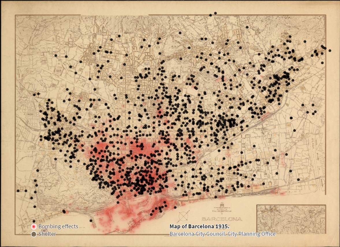
A new interactive map published by Barcelona city council on their website shows over 1,000 bomb shelters dating back to the civil war that were built by residents of the city and the local council.
The map, which you can find by clicking here, pinpoints the exact location of each and gives some details of shelters in cases that they are known.
The shelters gave refuge to citizens protecting themselves from Francoist bombs, while also pointing out the areas of the city that were most affected and targeted by the air raids.
From the map, it can be clearly seen where Frano’s troops aimed when bombing the Catalan capital. Most of the bombs were targeted around the port, the coastal neighbourhood of Barceloneta, and the old town where much of the civilian population lived.
More shelters were built in the Eixample district, possibly due to the ease with which they could be built there and the size of the population that lived in the area as the city was expanding outward from the old town.
Some of the shelters are open to visit, such as Refugi 307 in the Poble Sec neighbourhood, Refugi 0232 in Gràcia, and Refugi 0469 in Sant Andreu.
The bomb shelters have gone on to become “symbols of popular self-organization, resistance and struggle” in modern times, with neighbourhood groups coming together to work on their preservation.
The map, created by the Department of Democratic Memory and the Archaeology Service of the Barcelona City Council, details the work of historians and specialists done over the last 20 years, but by admission, they say they do not consider the work to be completed.
By publishing the map and giving more information to citizens, they hope to allow further participation by everybody to contribute to the constant renewal of the archive of bomb shelters.
On the interactive map there is also information regarding “what to do when documenting a shelter, how archaeologists work in their documentation, and about the historical context in which these confined structures had to be built, creating an underground city to flee the horror of fascist bombing.”