Southern Catalonia's devastating wildfire, a year on
Drone's view shows visible damage although vegetation beginning to grow back
A year ago, the Ribera d'Ebre, Segrià, and Garrigues counties in southern Catalonia suffered one of the most destructive wildfires in recent history, burning over 5,000 hectares of land.
The Catalan News Agency recently recorded drone images of the area to assess recovery a year on and followed the exact same route a firefighter's drone recorded last summer.
Fire damage is still visible especially in forest areas, where there are still plenty of charred trees, although some greenery is starting to grow back thanks to the heavy rains this spring as well as cleanup and reforestation that has been carried out.
Farmers have been able to recover some of the land for their crops, as is the case of Vall de Bovera's olive trees, also visible from above.
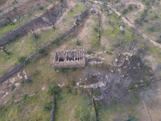
Another drone-captured site is the Remei hermitage, just north of the hard-hit town of Flix, where at one point flames dangerously approached the chapel. And in Flix, where 3,000 hectares were lost to the fire, the devastation of burnt wooded areas is still palpable a year later.
The wildfire, one of the worst to ever hit Catalonia, is thought to have been caused by a store of manure self-combusting as temperatures climbed above 40ºC. The manure pile "caused enough heat to explode and generate sparks," reported interior minister, Miquel Buch.
Around half of the affected area, some 2,500 hectares, was woodland. 1,514 hectares of shrubland were burnt, which have since recovered significantly, as well as 950 hectares used for crops and another 60 for fodder.