Two-thirds of Catalonia's beaches show long-term regression trends
Northern Empordà area has seen most loss of sand, while Barcelona area has gained most
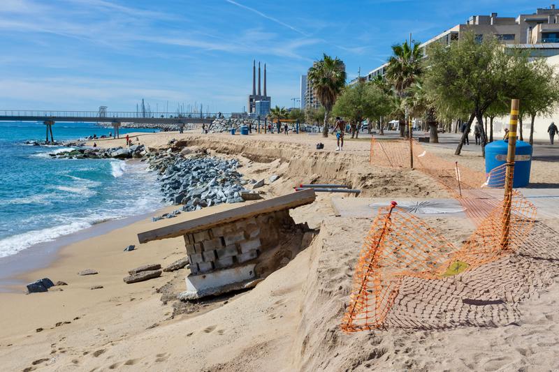

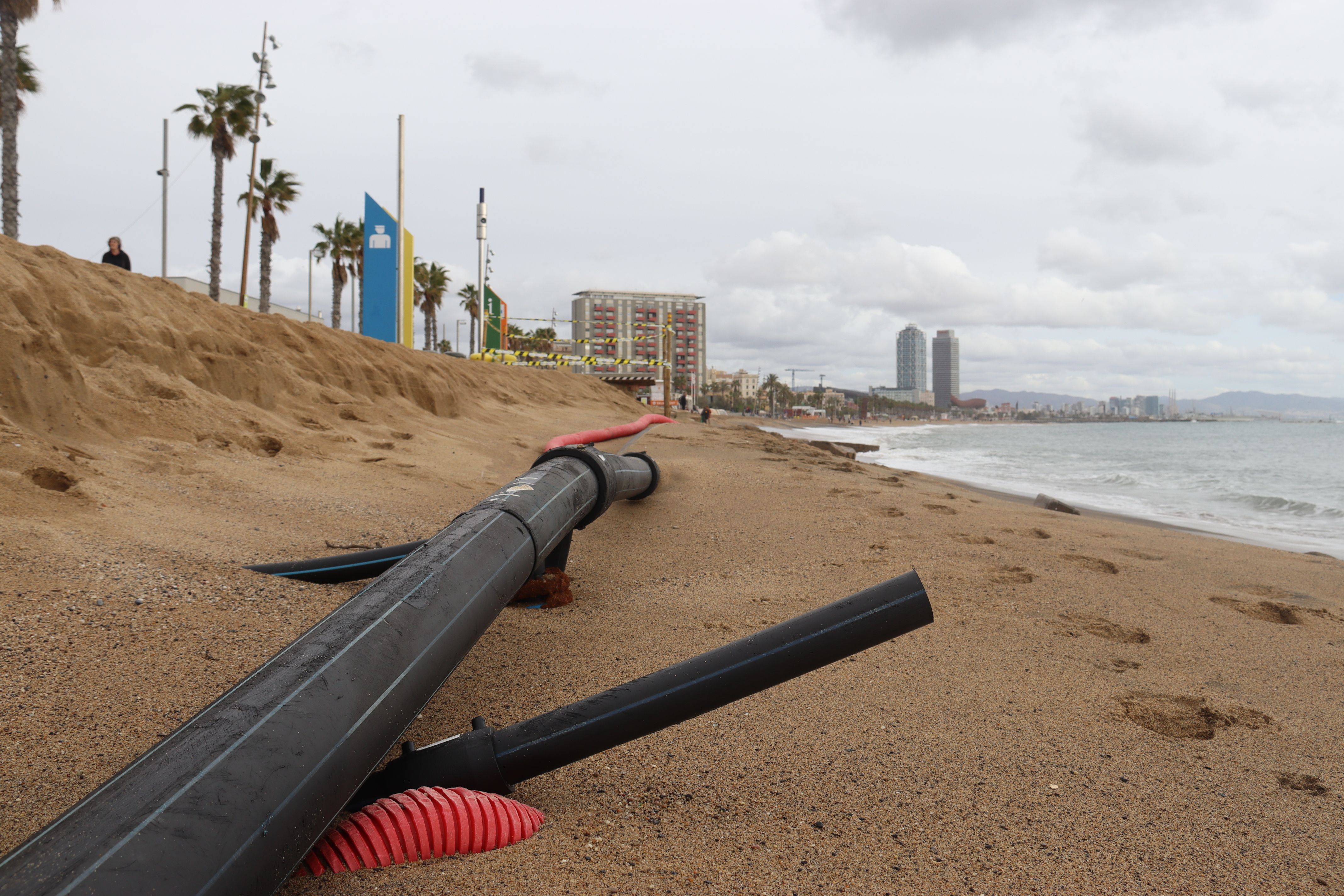
Nearly two out of every three Catalan beaches have lost sand and surface area in the last seven decades.
According to preliminary data from a study by the Cartographic and Geological Institute of Catalonia (ICGC) to which the Catalan News Agency (ACN) has had access, 65% of the beaches have suffered regression between 1956 and 2019. In total, 319 of the 489 beaches for which we have data have lost surface area.
Conversely, 35% (170 beaches) have grown in the same period.
The regions with the most beaches affected by the retreat have been Baix and Alt Empordà, with 70%, while most of those in the metropolitan area of Barcelona have extended their stretch of coastline.
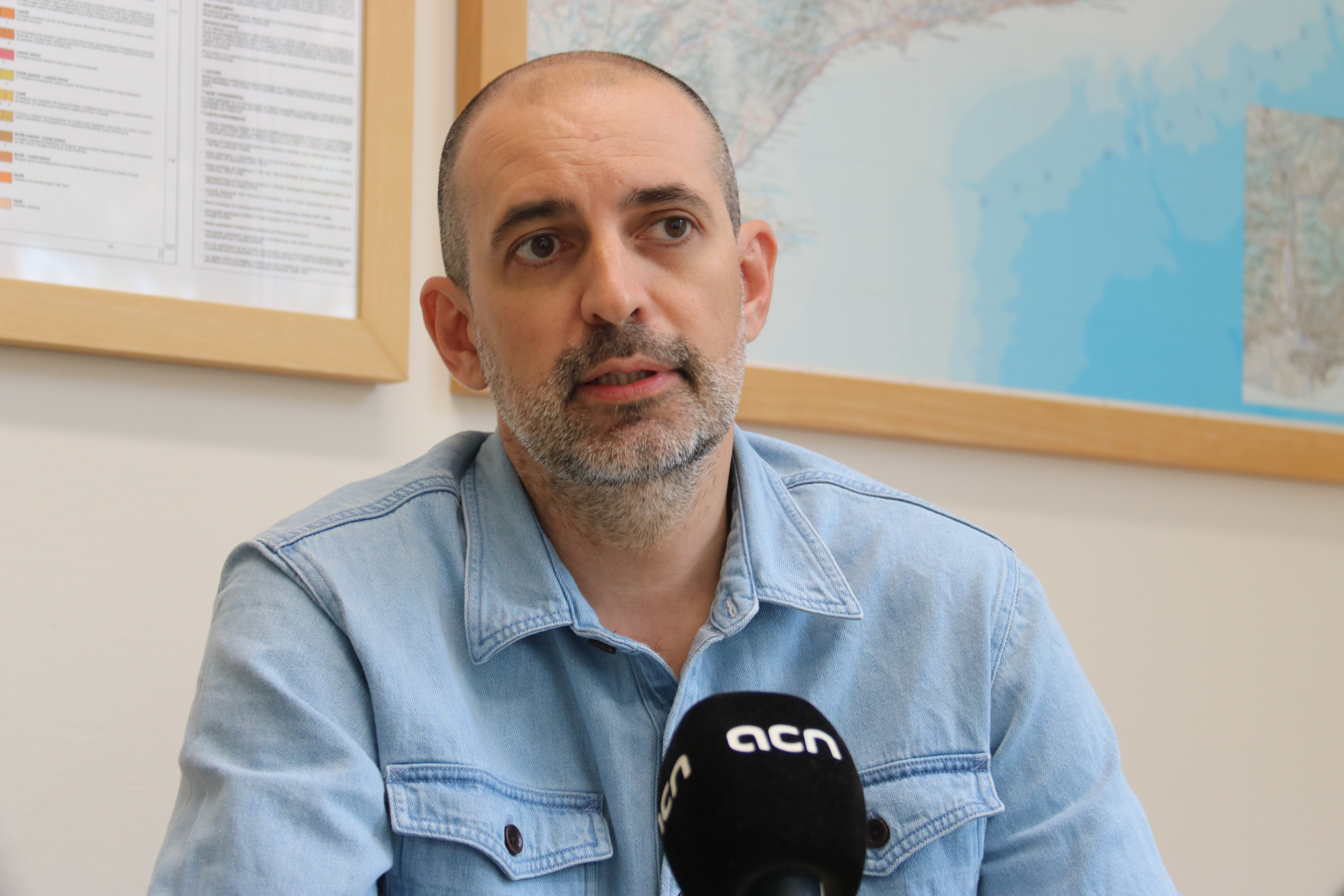
“59% of the Catalan coast is developed within 100 meters of the water,” explains Jordi Pinyol of the ICGC. “But if we take the Ebre Delta and Cap de Creus out of the equation, this proportion rises to 81%. This makes it very difficult for the beaches to naturally adapt to the swell conditions.”
“In addition, there is a deficiency of sediment as it’s not reaching the beaches from rivers and streams. On top of that, in the last 30 years, the sea level has risen by 10 centimeters. The trend is definitely that the beaches are regressing.”
Pinyol indicates that the Catalan coastline, in 1956, was 740 km, while in 2019 it grew to 911 km due to the construction of structures such as ports, sea dikes, and breakwaters.
However, the institute warns that the data collected is part of a preliminary study that still needs to be studied in more depth, beach by beach, and that it does not have records for all Catalan beaches.
“We must bear in mind that on Catalan and Mediterranean coasts, there are natural phenomena at play, without natural dynamics, heavily influenced by the presence of humans. All of this must be studied in more detail, because any changes in beach structures we have been able to see in aerial photos over time can have a direct relationship with humans.”
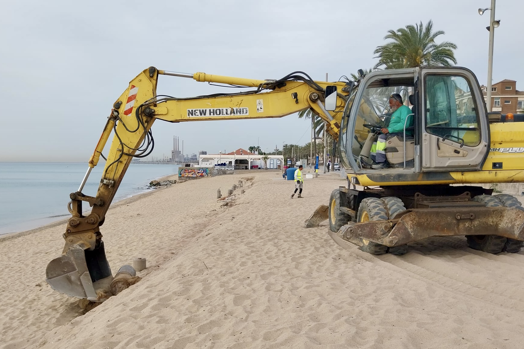
Pinyol explains that storms offer “good models” to study what can happen at beaches. “Last October and November we had several storms which all had practically the same direction of waves. Therefore, they have affected beaches which are all similarly oriented.” The researcher added that a storm does not need to be very powerful to generate damage on a weakened beach.
Last decade
The ICGC study also includes a comparison between 2010 and 2019. In this period, of the 553 beaches studied with available results, 273 have suffered regression (49.4%) and 280 have grown, 50.6%.
The figures therefore show more balance in comparison with the seven-decade figures, but the trend of which regions are seeing their coastlines recede is similar to the full data gathered since 1956.
"The beaches to the north of a port are growing, because they take sand, while to the south of the infrastructure they are thinning, that's why there is this apparent balance between beaches that are growing and beaches that are regressing,” Pinyol points out, in reference to the data from the Maresme region near Barcelona.
To study the evolution of beaches, data from four aerial photography flights taken in 1956, 2004, 2010 and 2019 were collected and, from these, the ICGC carried out the analysis using the Digital Shoreline Analysis System (DSAS), US Geological Survey software, which allows comparing different coastlines to extract lengths and speeds of beach movements.
For 13 years, the ICGC has carried out flights to take photographs at least once a year to determine the evolution of the Catalan coast.