Satellite images show end of drought as greenery returns to Catalonia
Terres de l'Ebre, the plain of Lleida, and the central regions no longer the arid brown as seen in recent years
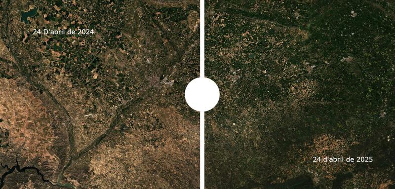

The green color of spring vegetation has returned to Catalonia after years of arid brown prevailing in satellite images of the territory due to the severe drought and lack of rain.
The change is visible from satellite view, as shown by the Sentinel-2 images of the EU's Copernicus program obtained by the Catalan News Agency.
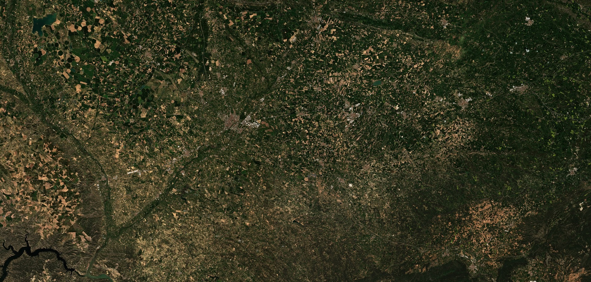
Crop areas have seen a starker change in colour more clearly than forested areas, which generally have not lost their green during recent spring seasons.
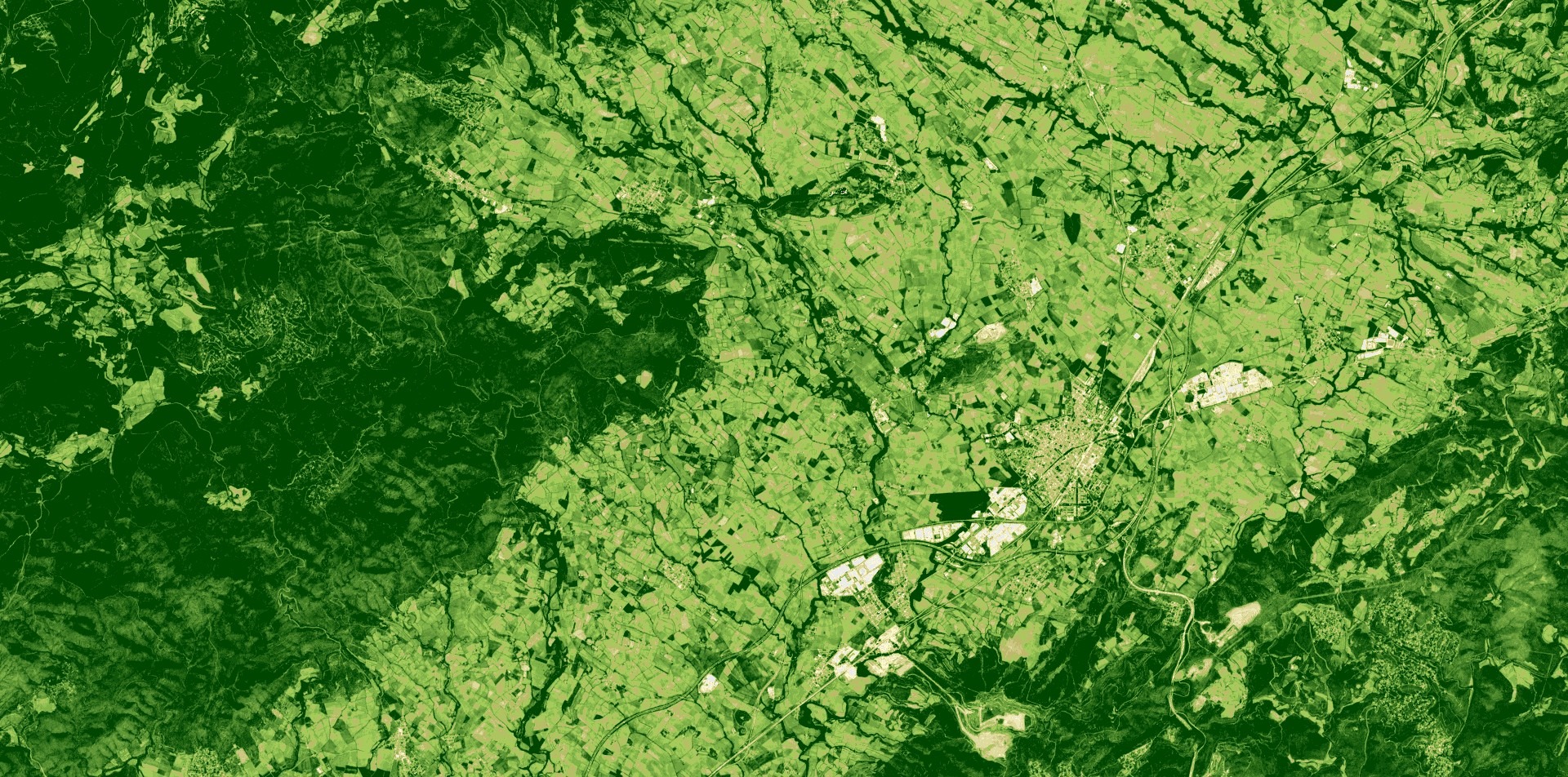
The southern Terres de l'Ebre, the plain of Lleida, and the central regions are some of the areas that stand out most, as well as Empordà, Camp de Tarragona, and Penedès, which are all now greener.
This week, the government approved the transition to a 'normal' drought situation in almost the entire region.
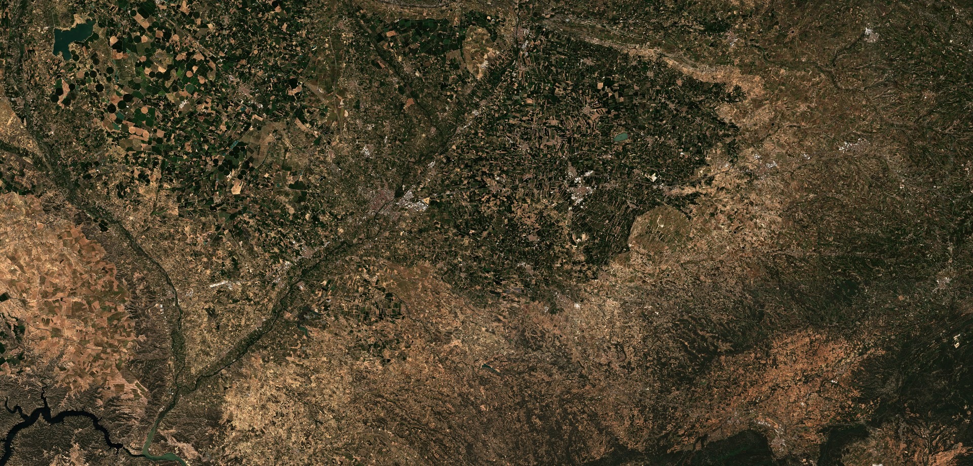
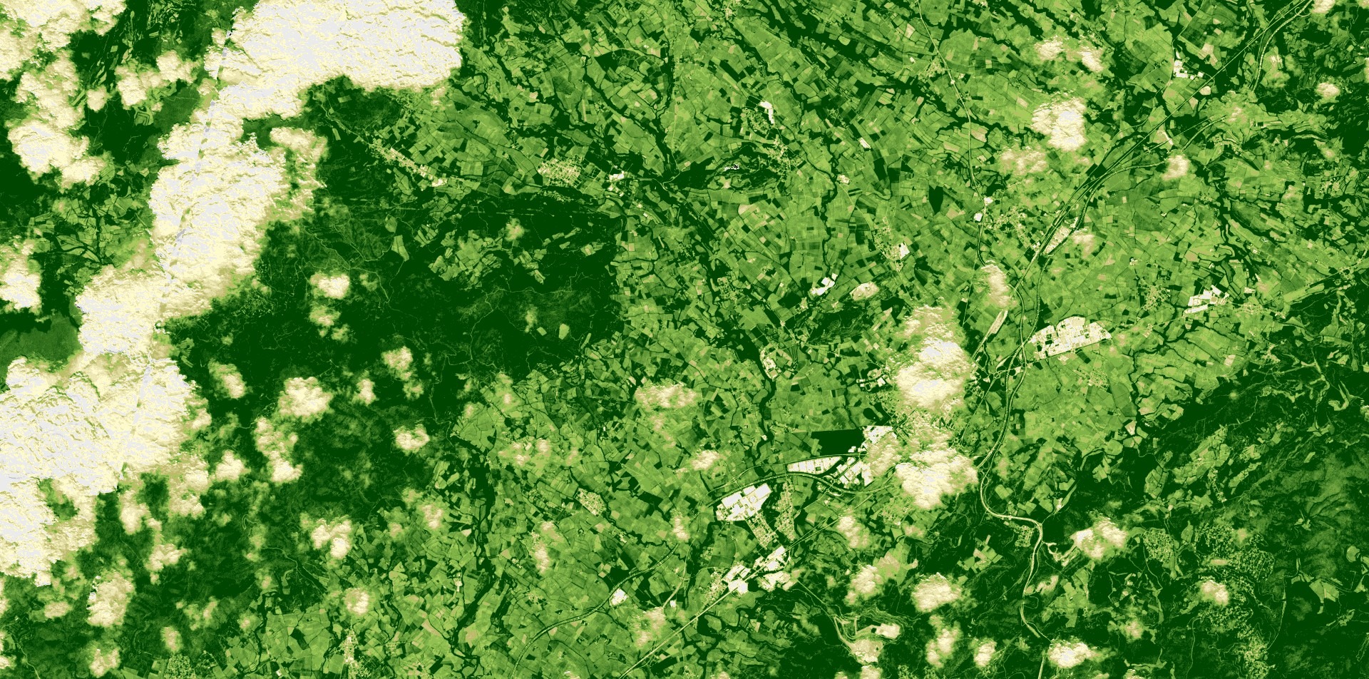
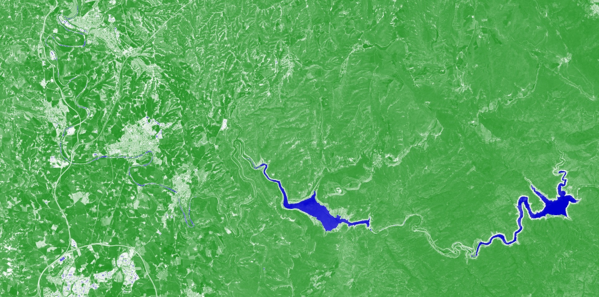
In the comparative satellite images of the Ponent area, with the western city of Lleida in the center, the change has been especially visible.
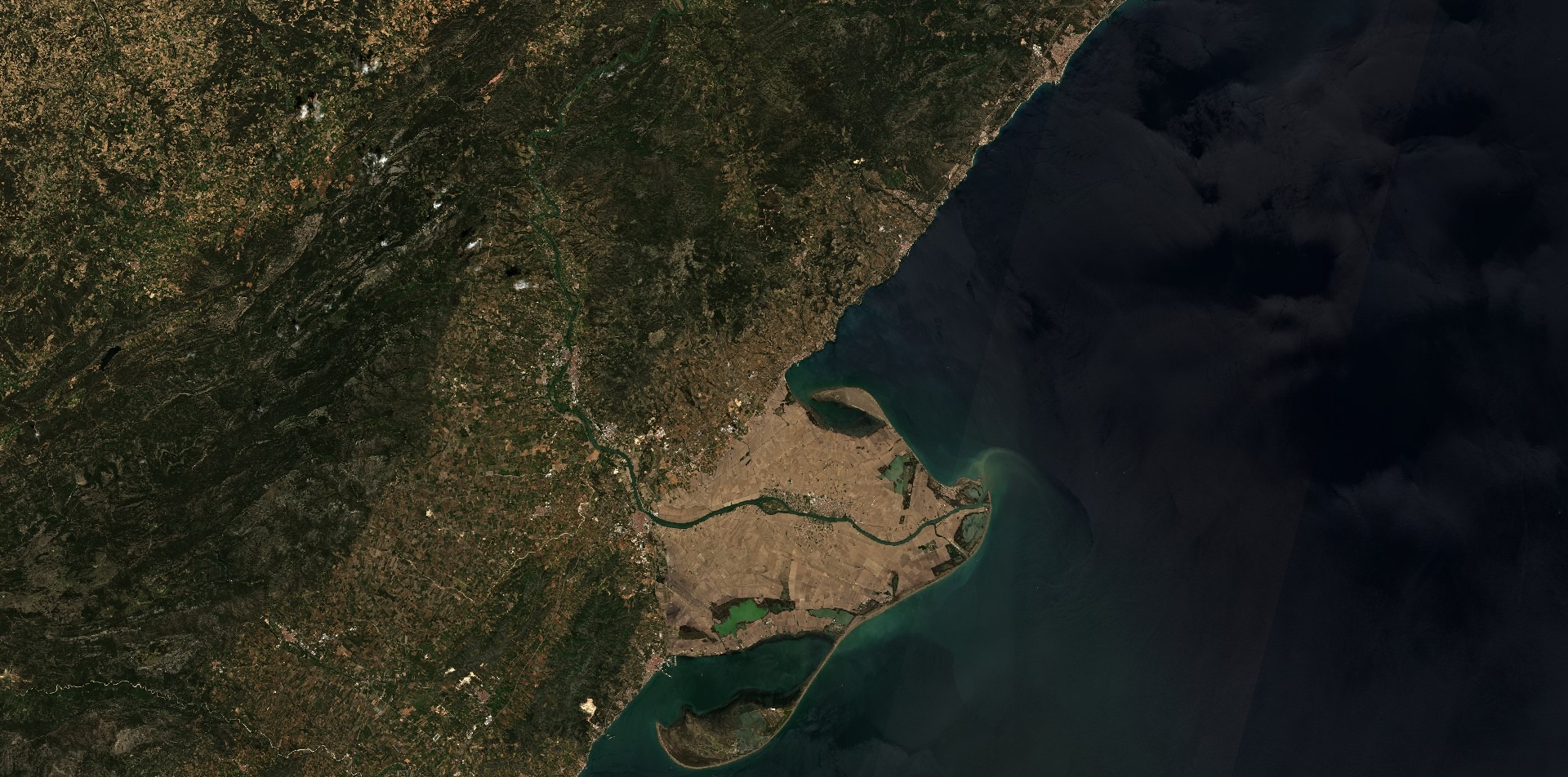
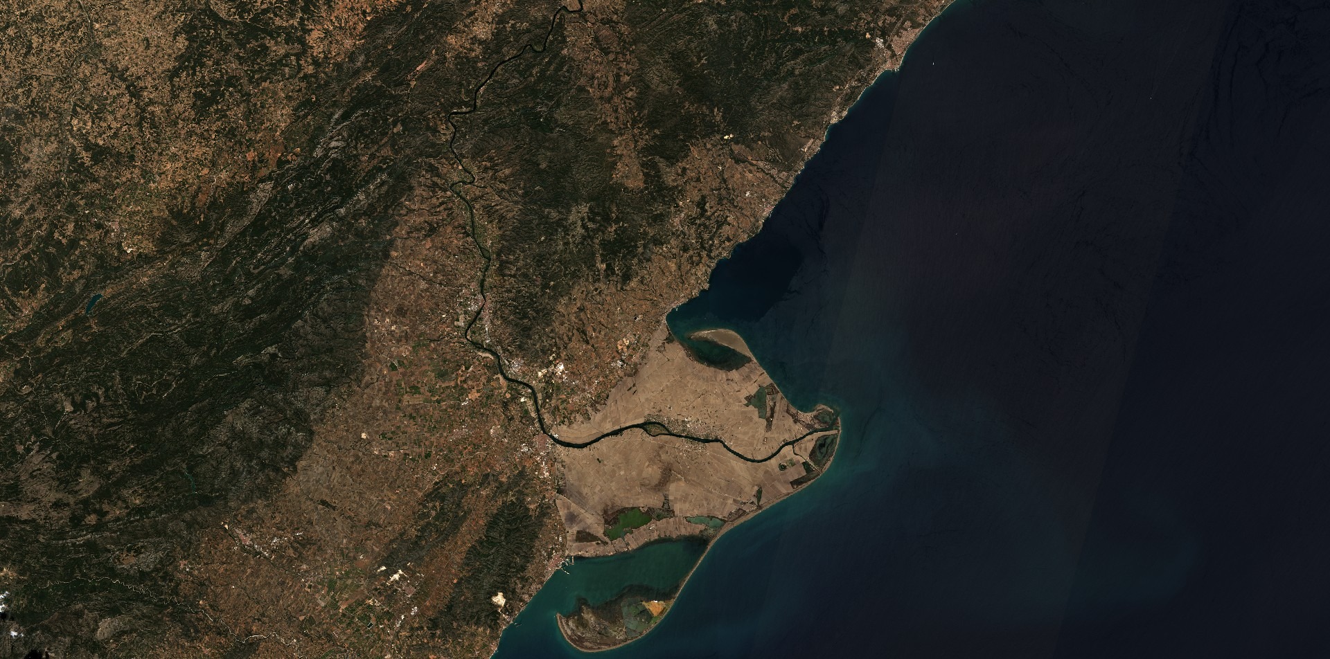
The drought lasted for three years, so the brown due to lack of water has been visible for several spring seasons. In the Terres de l'Ebre, in southern Catalonia, the satellite images also capture the transformation of the landscape in the Ebre riverbed itself.
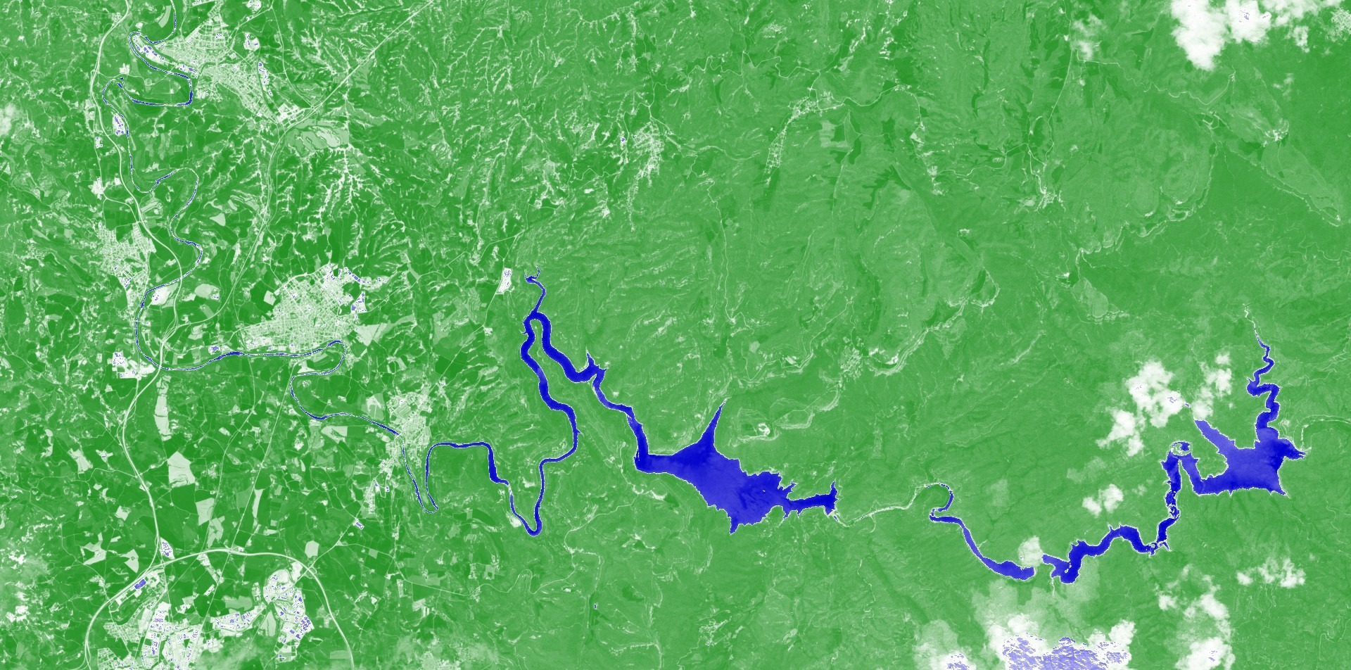
Reservoirs have also seen a massive change in the past months. The northern Sau and Susqueda reservoirs were at only around 5% and 25% capacity a year ago. Now, both are around 75% full.
Vegetation is growing healthier across the territory. Dark green areas show denser vegetation growth in the satellite images in the areas of Baix and Alt Penedès, meaning crops such as vineyards are more robust.