Drone images reveal scars of Baix Ebre wildfire one year on
Aerial footage shows limited restoration work after Paüls blaze destroyed more than 3,300 hectares
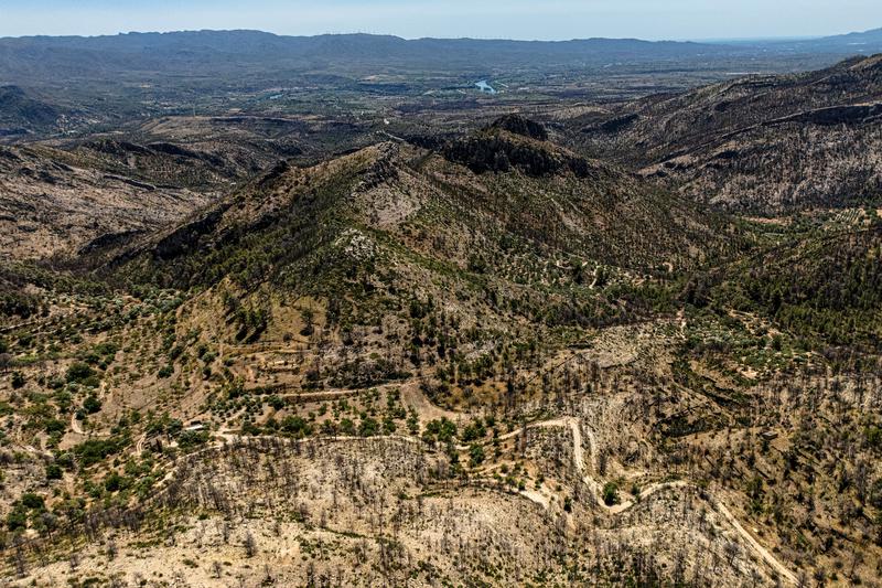

One year on from the Paüls wildfire in the Baix Ebre region, drone images show that the scars left by the blaze remain largely unchanged, with little restoration work carried out across the affected landscape.
The fire, which began near the town of Paüls, burned through 3,321 hectares of forest and agricultural land.
It spread towards Alfara de Carles and the Els Ports Natural Park before shifting direction on its first night due to strong winds, moving towards the Ebre river.
The flames reached the outskirts of Aldover and Xerta, eventually crossing the river to Tivenys.
Aerial images captured by the Catalan News Agency (ACN) one year later show only limited signs of recovery.
Small clearings can be seen in some areas where private companies, coordinated by local councils, are removing burned trees.
The loss of forest cover has also revealed traces of the agricultural landscape that once covered the area.
After a winter spent under a blanket of ash, undergrowth has begun to regrow among the scorched pine trees, holm oaks and fruit trees still awaiting removal.
The drone images also reveal cultivated areas that survived the blaze because they had been maintained, as well as the first clearings appearing in burned woodland where forestry companies are carrying out clean-up work.
The fire once again highlighted the consequences of abandoned farmland in the Baix Ebre region, as had previously occurred in the 2019 Ribera d'Ebre wildfire.
One year on, the deforestation caused by the blaze shows the scale of the agricultural patchwork that disappeared over the second half of the 20th century and into the present day.
Rows of traditional dry-stone terraces have reappeared, stretching up mountain slopes and peaks, along with small ruined farm buildings.
The fire has also transformed the landscape around the Vall d'Orella, Xiveli and Fornets ravines. Previously hidden beneath dense vegetation, the waterways are now fully exposed and cleared.
"Grieving process"
Local authorities say recovery efforts remain incomplete, with communities still waiting for promised forest clearing work and direct financial assistance for those affected.
Xerta was the worst-hit municipality, with the fire reaching the edge of the town and burning around 30% of its municipal area.
Mayor Roger Aviñó says residents have had to go through "a very significant grieving process" as the landscape they knew has changed, but he is particularly critical that promised support has not arrived.
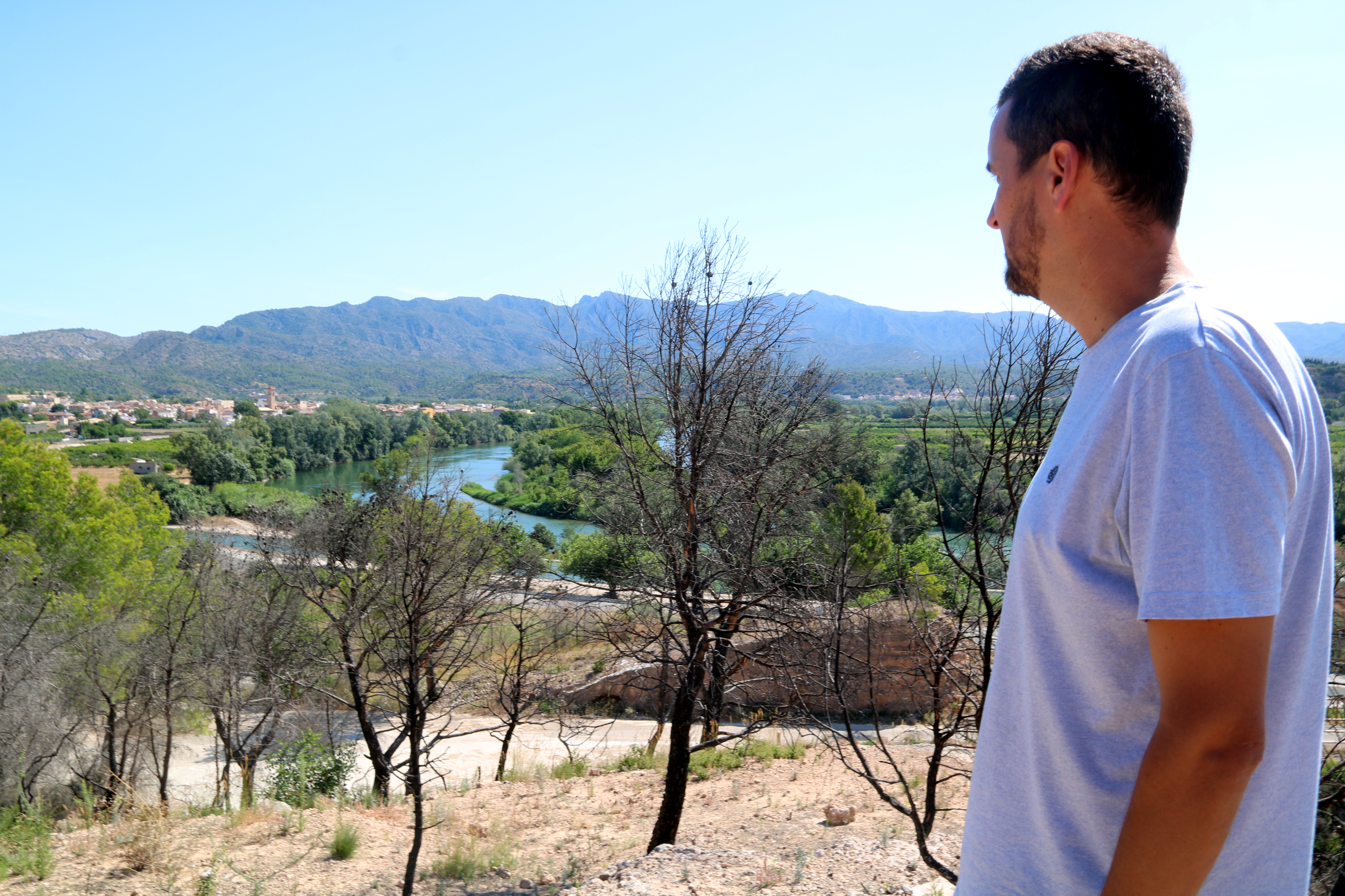
The blaze, which investigators believe was caused by negligence in an agricultural area, burned more than 3,300 hectares, including one-third inside the Els Ports Natural Park. Two-thirds of the affected land was forest.
One firefighter died during firefighting operations.
Agriculture Minister Òscar Ordeig said the government has committed €28 million for forest management and prevention measures, and improving roads.